Hibberts Gore, Maine
Appearance
(Redirected from Hibberts, ME)
Hibberts Gore, Maine | |
|---|---|
| Gore of Hibberts Gore | |
| Nickname(s): | |
 Location in Lincoln County and the state of Maine. | |
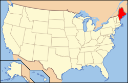
 Maine's location in the United States. | |
| Coordinates: 44°19′33″N 69°25′39″W / 44.32583°N 69.42750°W | |
| Country | |
| State | |
| U.S. Congressional District | ME-1 |
| County | Lincoln |
| Area | |
• Total | 1.95 km2 (0.752 sq mi) |
| • Land | 1.93 km2 (0.745[2] sq mi) |
| • Water | 0.02 km2 (0.007[2] sq mi) |
| Elevation | 91 m (299[1] ft) |
| Population (2020) | |
• Total | 1 |
| • Density | 0.5/km2 (1/sq mi) |
| Time zone | UTC-5 (Eastern (EST)) |
| • Summer (DST) | UTC-4 (Eastern Daylight (EDT)) |
| ZIP codes | |
| Area code | 207 |
| GNIS feature ID | 582518[1] |
| FIPS code | 23-015-32715[4] |
| Waterways | Crummett Brook[5] |
Hibberts Gore (also called Hibberts) is a gore in Lincoln County, Maine, United States. The gore's population was one as of the 2020 United States census.[6]
History
[edit]Ignored by the surveyors who mapped Maine, it is one of many locales in Maine that remained unincorporated as most of the rest of the state was divided into cities, towns, and plantations.
Demographics
[edit]| Census | Pop. | Note | %± |
|---|---|---|---|
| 1940 | 1 | — | |
| 1950 | 1 | 0.0% | |
| 1980 | 2 | — | |
| 1990 | 1 | −50.0% | |
| 2000 | 1 | 0.0% | |
| 2010 | 1 | 0.0% | |
| 2020 | 1 | 0.0% | |
| U.S. Decennial Census[7] | |||
As of the 2020 census, there was 1 person, 1 household, and 0 families in Hibberts Gore.
See also
[edit]- Monowi, Nebraska – an incorporated village with a population of one.
References
[edit]- ^ a b c d e "Hibberts Gore". Geographic Names Information System. United States Geological Survey, United States Department of the Interior. 1 September 1995. Retrieved 22 June 2015.
- ^ a b 2010 Census National County Subdivisions Gazetteer Files for Maine (Report). U.S. Department of Commerce. 2010. Retrieved 22 June 2015.
- ^ "US Postal Code Boundaries". Google. Google Maps. 3 February 2014. Retrieved 22 June 2015.
- ^ U.S. Census Bureau. Census 2000. "Census Demographic Profiles, Hibberts Gore" (PDF). CenStats Databases. Retrieved 22 June 2015.[dead link]
- ^ "Crummett Brook". Geographic Names Information System. United States Geological Survey. 30 September 1980. Retrieved 22 June 2015.
- ^ "Explore Census Data". data.census.gov. Retrieved 2024-03-25.
- ^ "Census of Population and Housing". Census.gov. Retrieved June 4, 2015.

